Redevelopment for the New Museum of Modern Art in Brescia
Architecture, Aerial Photogrammetry, Cultural Heritage
The data from the following case study were kindly provided by Nicola Liguori, graduating student in Building Engineering from the School of Architecture and Construction Engineering of Politecnico di Milano, Italy.
His dissertation is part of an architectural project of considerable importance relying on the collaboration with the Museum of Santa Giulia, the main museum in the city of Brescia, Italy. In particular, the museum felt the need to expand the warehouses for its artistic works. Therefore, the design of the new Museum of Modern Art in Brescia began, through the recovery of the “Casere”, a disused building located in the area of the former General Warehouses of Brescia.
Project goals
“My goal right from the start was to concentrate more than one public function in one building. Designing and planning a place for art intended as a space for the community is the central core of the recovery of the Casere.”
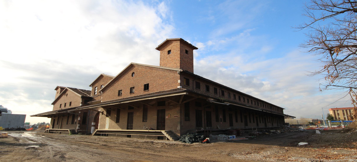
Nicola’s project had its first concrete realization with the survey of the building (fig.1) by exploiting aerial photogrammetry in order to properly reconstruct the current state of the Casere through point clouds, textured meshes and orthophotos of the different façades. That was possible thanks to appropriate UAV systems to take aerial photos, a pilot’s license for critical operations and 3DF Zephyr Aerial for data processing.
The 3D reconstruction of that building led to the development of a functional definition and volumetric composition process to meet the needs of the new museum, by keeping an eye also on ecological innovation and consumption savings thanks to the use of sustainable materials.
Scenario and survey description
The Casere building is located south-west just outside the city center of Brescia. However, despite it being an urban scenario, the absence of flight restrictions along with the pilot’s license for critical operations allowed the survey to be carried out on December 2, 2018.
A drone DJI Phantom 4 Pro Plus, equipped with a CMOS 1″ camera sensor of 20MP and a 24mm lens, was used to capture the whole area. To do that, and in accordance with the rules established by ENAC (Italian Civil Aviation Authority) while setting a theoretic GSD of 0.8 cm/pixel, a few unscheduled flight missions were performed. Another survey was carried out at a later time, aimed at capturing only the roof of the building in a more accurate and detailed way. Specifically, nadiral photos were taken in JPG format through two automated scheduled missions lasting about 17 minutes, with an overlap of 80%. The flight altitude was 35 m with a speed of 10 km/h, and 924 nadiral pictures were collected.
The last image dataset affected the different façades, setting manual flight missions at three different altitudes of 4, 8, and 12 meters while keeping a distance from the building of about 10/12 meters. The front overlap between the pictures was 80% and the side overlap was 40%. In this case, the images came in RAW format, with intervals of about 5 seconds at a speed of 4/5 km/h. Once the missions were completed, 514 photos were taken for the North, East, West, and South façades.
Thirty targets were previously placed to the ground and placed evenly around the building to get the 3D model scaled; however, due to the absence of tools such as total stations, the coordinates of the targets were detected with the drone’s integrated GPS system. Coordinates were then slightly corrected using the local maps as a reference, and the final accuracy of the GCPs turned out to be 3/5 cm, which was enough for the project’s purposes.
Data processing and outcomes
The pictures collected from scheduled flight missions were processed in 3DF Zephyr Aerial (v. 4.513) taking advantage of a computer with the following specifications:
- Processor Intel i7-6700 3.4 GHz
- RAM 32 GB
- Graphic card Nvidia Quadro K4200
- SSD 512 GB
A first project was started by importing the nadiral pictures of the area for sparse point cloud generation: this required processing time of about 8 hours and 45 minutes. The sparse point clouds of the four façades were processed individually using the frontal pictures, and once the Structure from Motion phase was done, the four clouds were then merged with the first “nadiral” sparse point cloud via control points.
The next steps were the dense point cloud generation, with an amount of 130,336,331 points, as well as the mesh extraction taking about 12 and 15 hours, respectively.
Finally, a high-definition textured mesh of 4,310,722 polygons was extracted in 13 hours and 30 minutes, with 100% image resolution.
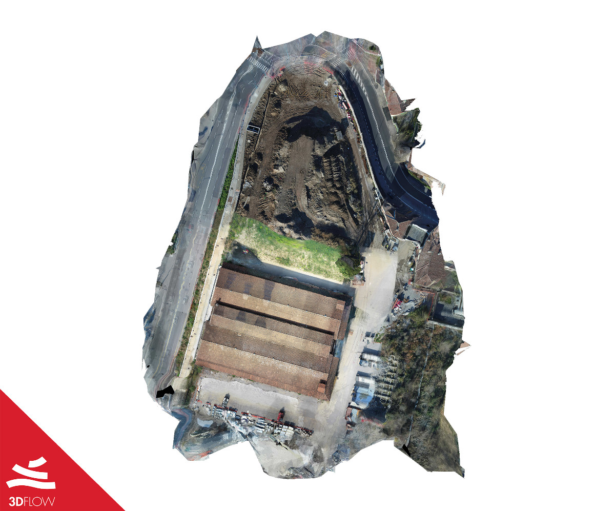
Additional outputs were the orthophotos of the different façades (fig. 2 – 3) and an orthophoto with a top view of the entire project area (fig. 4). As for this latter output indeed, it was necessary to integrate the 3D model of the building along with another larger one, reconstructed from the first unscheduled flight missions.
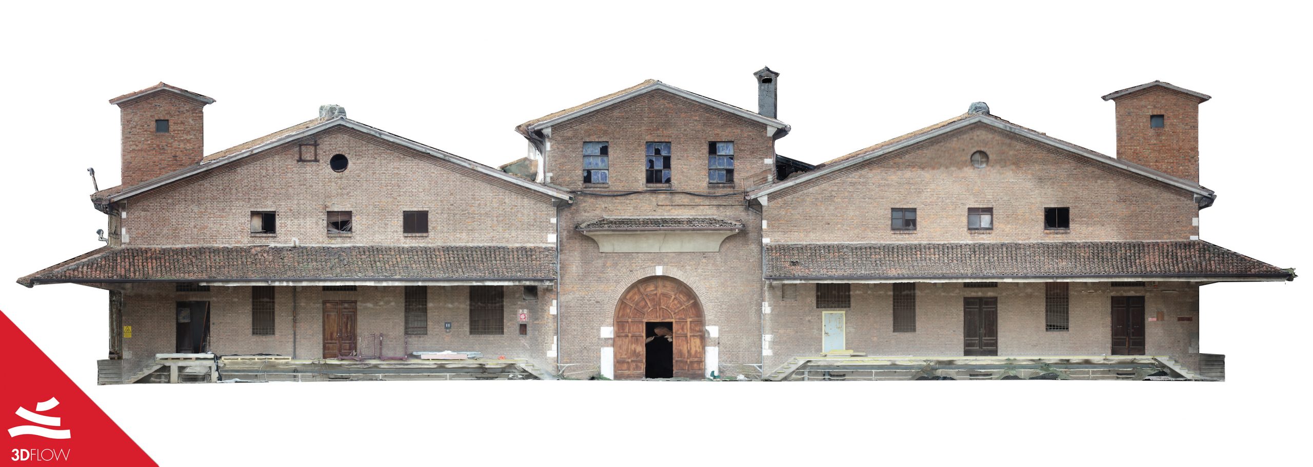
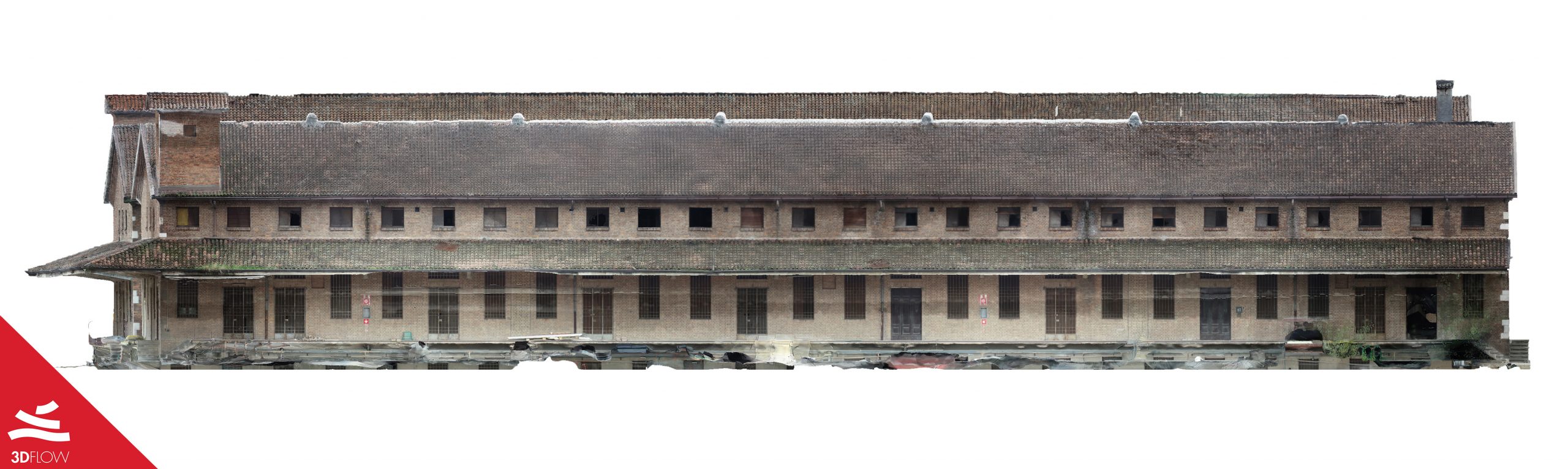
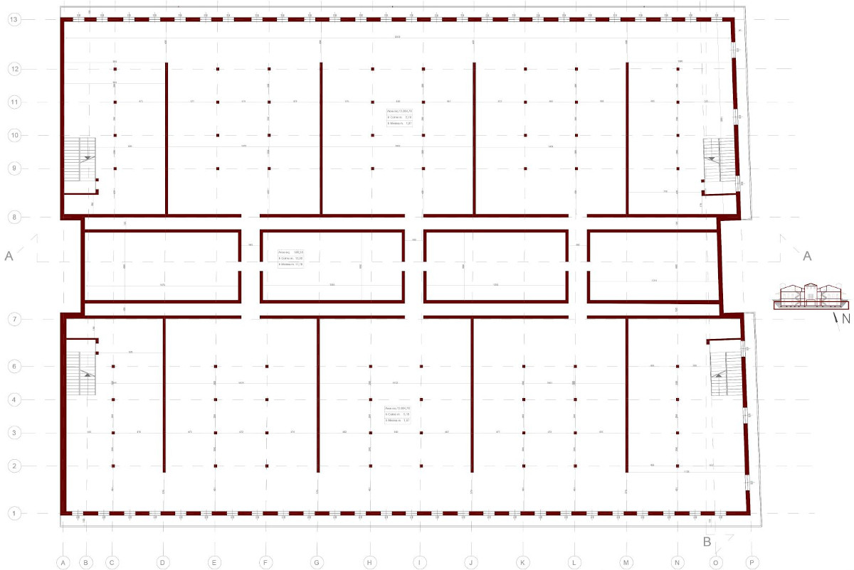
The orthophotos proved to be essential for the realization of CAD layouts of the survey (fig. 5) aiming to get useful information describing both the materials and the state of the building’s degradation.
The recovery of the Casere building
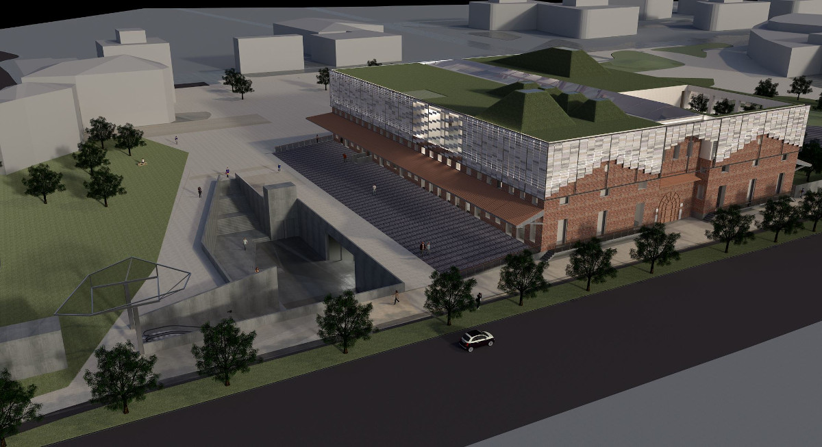
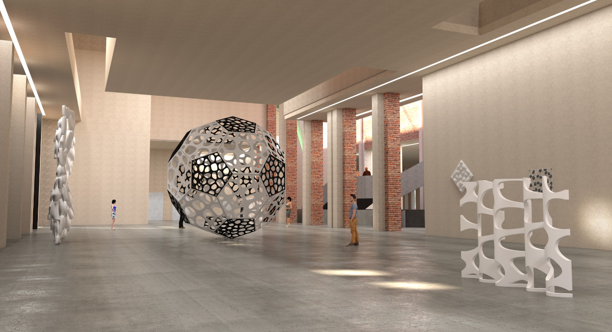
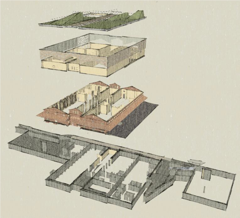
At that point, the strategy adopted for functional recovery of the building focused on the indoor areas only, as they suffered a severe degradation without affecting the external architectural aspect as it was. As Nicola explained, the idea behind it was to project a “new building within the building” that could revitalize its internal structure, obsolete and inadequate for the new function of the museum that would go to cover. To do this, he worked mainly on the underground volumes, adding a new space to the existing one; thus, a good trade-off was found between architectural innovation and the maintenance of the stylistic strengths characterizing the old building (fig.6).
Below, some final renderings of the project.