Case Study – Photogrammetry & BIM – Arch of Caracalla at Volubilis
The case study we will cover in this post has been provided by the research unit Dar_Med, a group of teachers and researches of the University of Florence.
 | Scientific advisor: Prof. Giovanni Pancani Editing: Filippo Romani |
Specific areas of competence of the Research Unit, among others:
● project and safeguarding of the city, the territory and the landscape;
● analysis and project concerning human settlements and dwellings (architecture of the city and of the landscape);
● survey and diagnostics;
● materials and structures for architecture;
● design for Cultural Heritage (design starting from and for the cultural heritage);
● design for sustainability and social innovation;
● recovery of built heritage and sustainability;
● knowledge, study and documentation of the historical-artistic, archaeological and architectural heritage;
Workflow
The research team headed by Prof. Giovanni Pancani took advantage of 3DF Zephyr to 3D reconstruct one of the most astonishing, to say the least, landmark of the surroundings, namely the Arch of Caracalla at Volubilis, the ancient capital of the kingdom of Mauretania located near today’s city of Meknes, Morocco.
The arch is about 9m high, 17m wide and 4,5m deep and required 353 raw pictures to be fully documented. Raw pictures were taken with a Sony Alpha DSLR-A900 featuring a full frame sensor and 25 megapixels.
Here is the kicker: approximately 20 different focal lengths from 30mm to 300mm were involved in this survey and some of them are very close to each other. (30-35-40-45-50-55-60, and so on). A dataset, therefore, designed to seriously challenge a photogrammetry software.
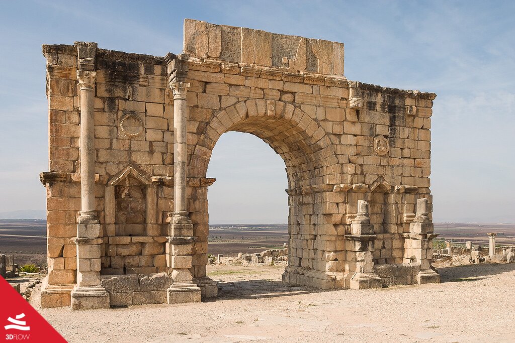
Figure 1. The Arch of Caracalla at Volubilis erected in AD 217 in honour of Emperor Caracalla and his mother, Julia Domna
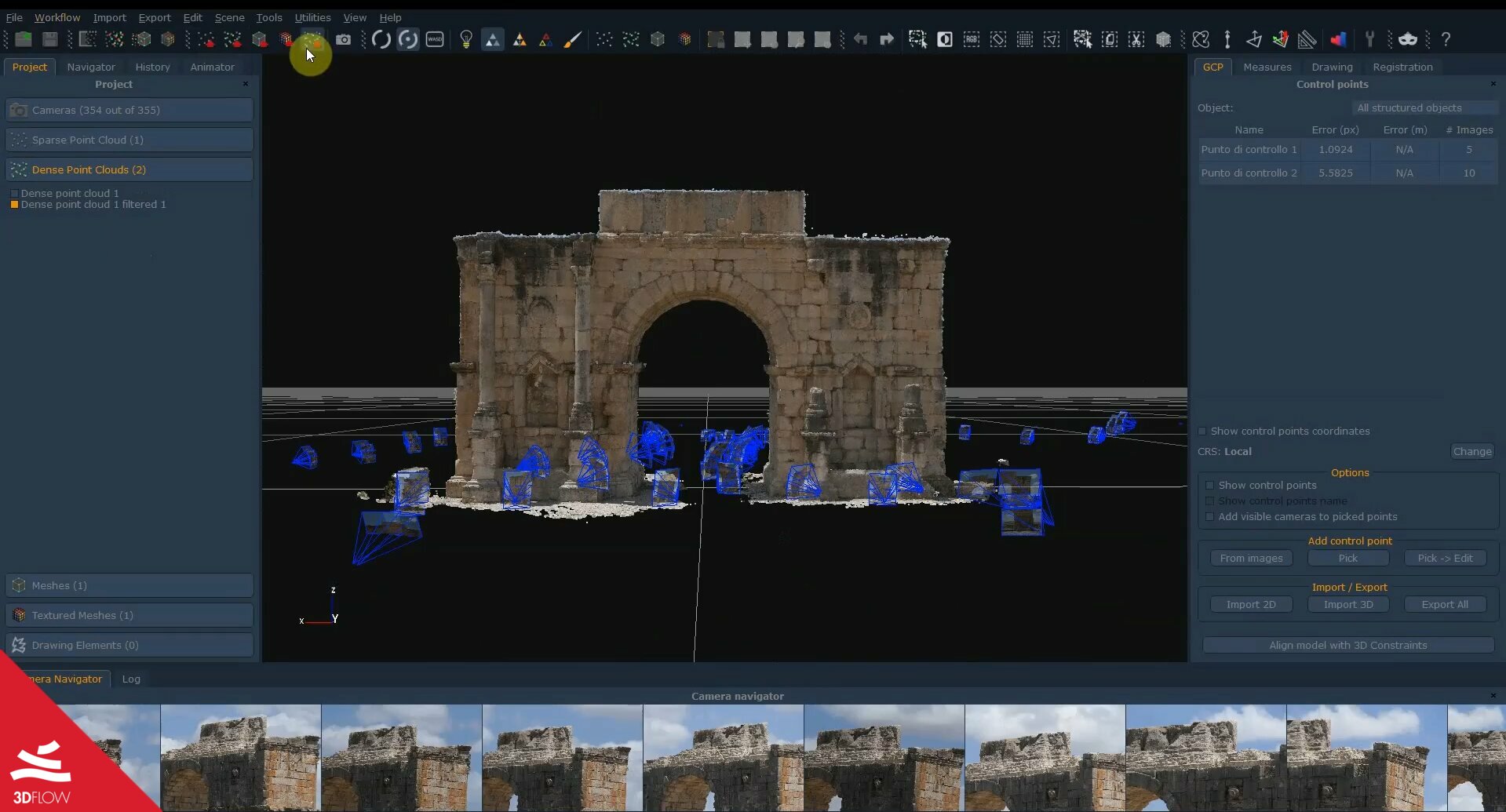
Figure 2. Dense point cloud generated in 3DF Zephyr.
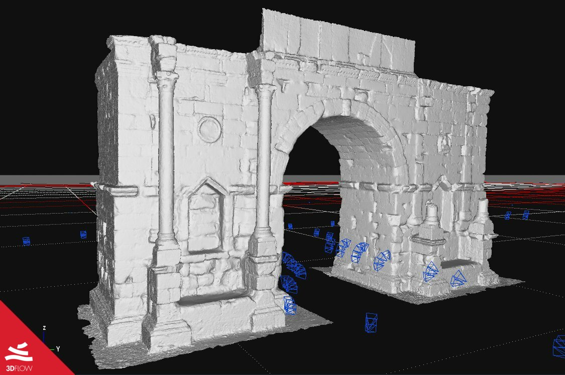
Figure 3. Mesh generated in 3DF Zephyr
The last step consisted of moving the 3D model from 3DF Zephyr Aerial to Revit in order to perform BIM modelling. So the GeoBim plugin was applied to easily synchronize the dense point cloud from Zephyr to Revit
For quicker and easier model management, the research team went for a point cloud decimation inside Zephyr before the synchronization with Revit.
All the details about the 3D workflow are available in the video below.
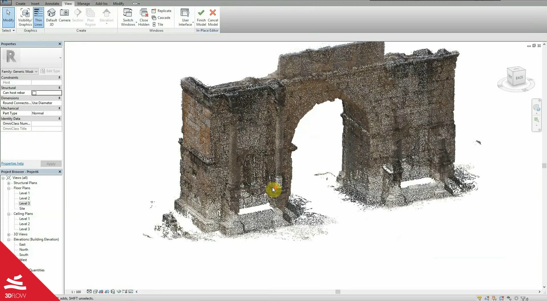
Figure 4. Dense point cloud synchronized in Revit
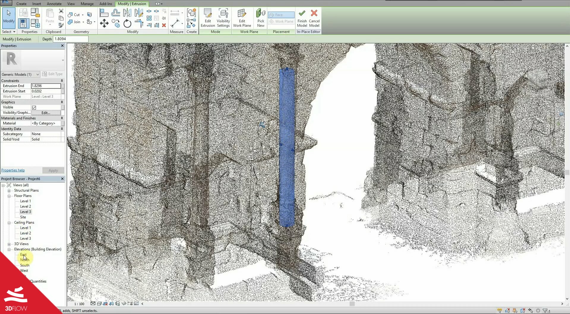
Figure 5. A sneak peek to a column being modelled in Revit