The Aqueduct Tower of Piadena Drizzona
Aerial Photogrammetry, Building Monitoring
All the data collected here have been kindly provided by the Italian company DL Droni Srl and its usage is authorized by the Municipality of Piadena Drizzona, located in the province of Cremona, Italy.

Area captured and survey goals
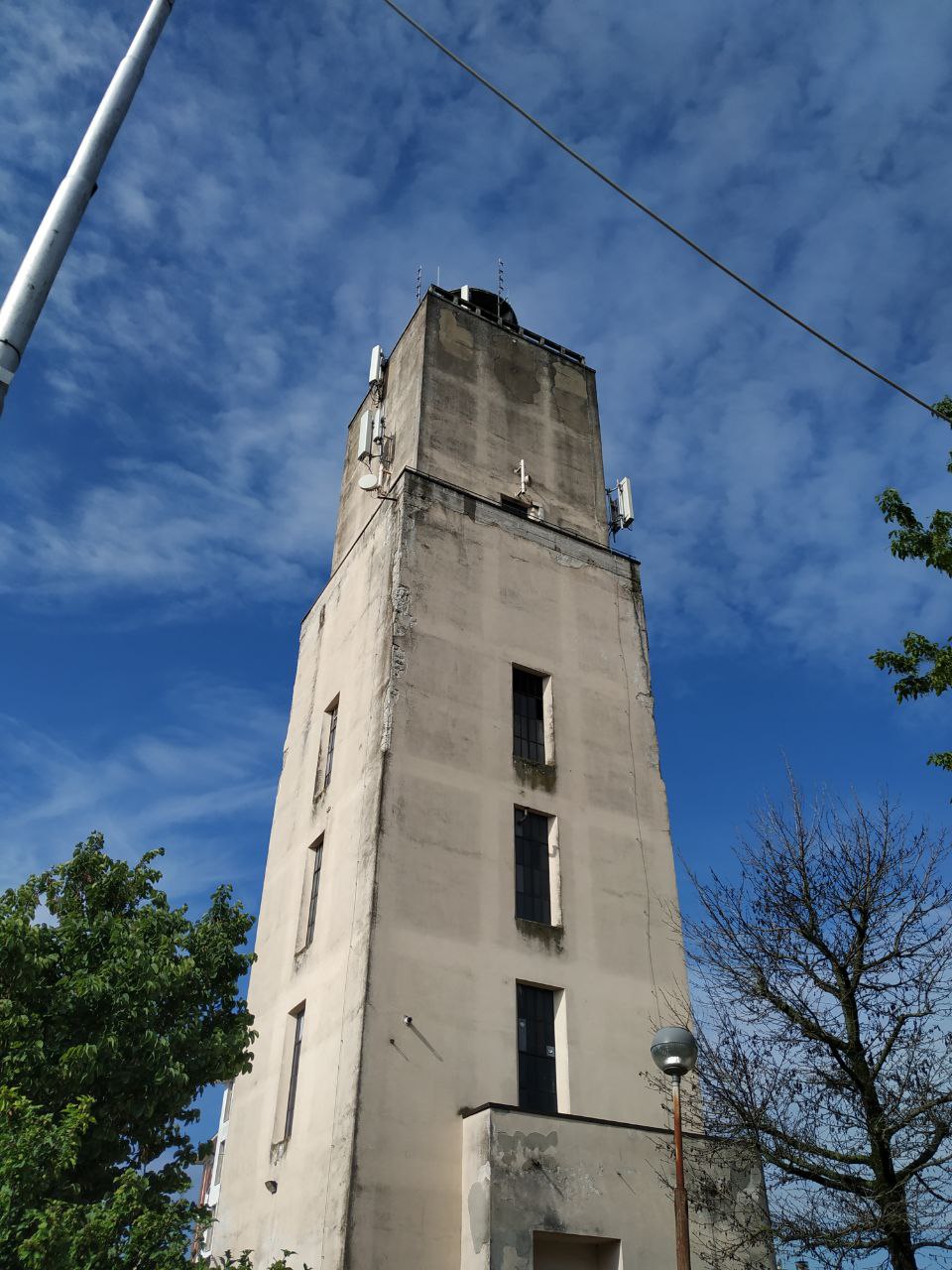
The aqueduct tower (Fig. 1) is visibly damaged due to the lack of maintenance over the years and shows exposed parts of iron over 20-30 meters; besides, weather conditions such as heavy rains and wind led to the falling to the ground of some parts of the external coating from a considerable height, thus representing a danger for people and nearby houses.
The tower has been on loan for use to a private company for years, but within the next months it’s going back to being property of the Municipality of Piadena Drizzona, which is now aiming to develop a recovery project of the building.
Therefore, the first step required was a visual and close analysis of the structure, along with a 3D reconstruction of the tower.
Survey equipment and data acquired
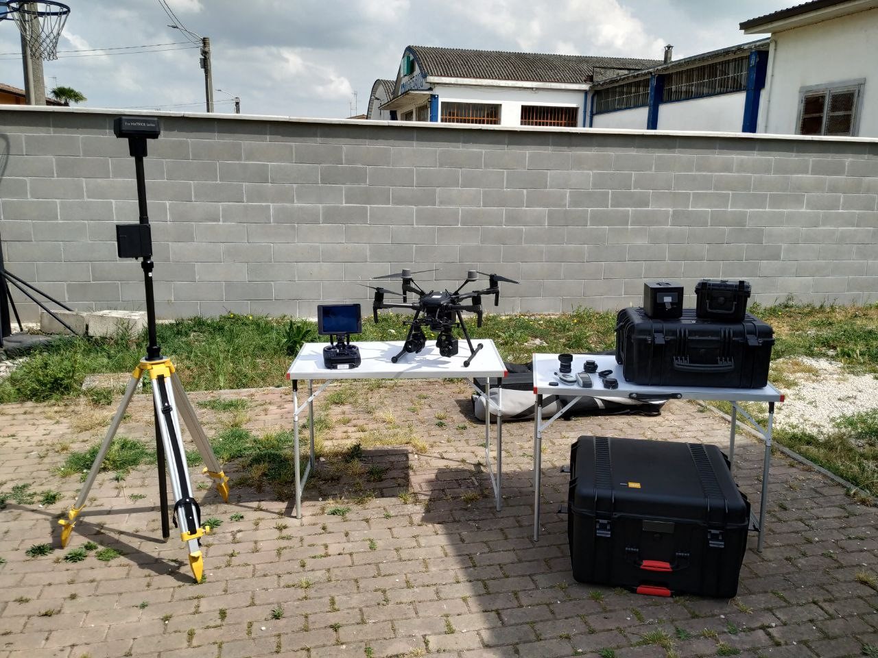
On 2nd May 2020, the survey was carried out, using a drone DJI Matrice 210 RTK V2, equipped with a DJI Zenmuse X5 15mm lens and a RTK ground station (Fig. 2).
The flight missions were performed shooting both nadiral pictures and oblique pictures at 45 degrees in manual mode and with manual overlap view.
Once the survey of the tower was completed, the drone took 528 photos in JPG format (with 5.280×2970 pixels resolution) which were later processed in 3DF Zephyr Aerial 4.530 for the next 3D reconstruction step.
Data processing
Once the pictures were imported within 3DF Zephyr Aerial, the Structure from Motion phase managed to orient correctly 528 photos on 528. In a second moment, the RTK coordinates present within the exif data of the pictures have been used to scale and georeference the 3D model, along with a Bundle Adjustment to improve its overall accuracy.
The final mean residual was 0.028 meters.
The workstation exploited to run the processing had the following specifications:
- Processor: Intel Xeon E5-2650L V3 CPU @ 1.80 GHz (12) Core
- RAM: 64 GB
- Hard disk: 1 x 480GB – SATA (6G) SSD + 1 x 1.000GB – SATA 7.2K
- GPU: Nvidia Quadro M4000 – 8GB
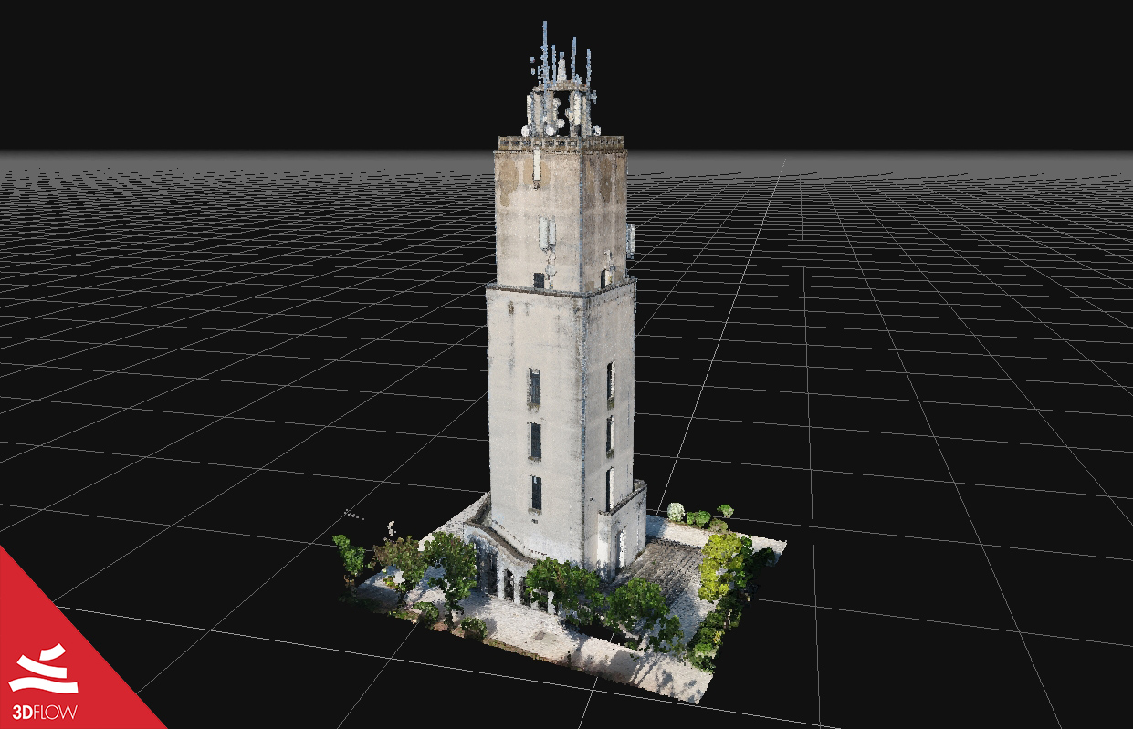
The whole reconstruction process took around 16 hours; the outcomes were a dense point cloud made of 3.796.067 points (Fig.3), a mesh and a final textured mesh of about 3,987,722 triangles (Fig.4).
A new test was carried out using the new 3DF Zephyr 5.0 on a different and less performant workstation with these specs:
- Processor: Intel Core i7 6920HQ CPU @ 2.90 GHz
- RAM: 32 GB
- Hard disk: SSD 512GB + HDD 1 TB
- GPU: Nvidia Quadro M2000M – 4GB
Results displayed very significant improvements in terms of accuracy and especially in speed if compared to the previous version 4.5, as shown in the following table:
| Steps 3D reconstruction | Settings used | Processing times |
| Sparse point cloud | Aerial – Nadiral Images / Default | 0h 32m 10s |
| Dense point cloud | Aerial – Nadiral Images / High Details | 3h 12m 36s |
| Mesh | Aerial – Nadiral Images / High Details | 1h 32m 49s |
| Textured mesh | General / Default Multi Texture | 0h 18m 11s |
Indeed, this time the 3D reconstruction took less than 6 hours to finish all the phases.
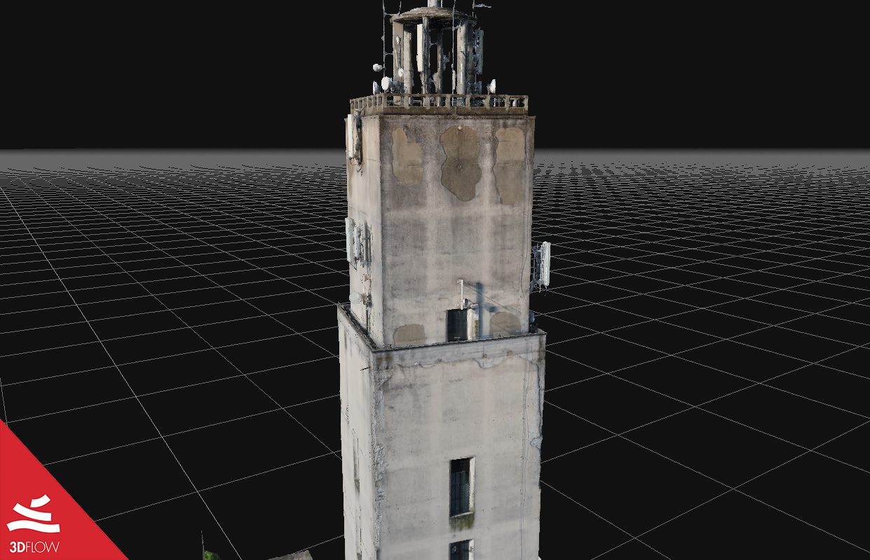
Below some screenshots of the final model of the Tower Aqueduct.


3D mesh geometry (left) and texture (right) of the tower base. © DL Droni Srl


3D mesh geometry (left) and texture (right) of the tower façades. © DL Droni Srl


3D mesh geometry (left) and texture (right) of the tower top. © DL Droni Srl