The Verruca Fortress
Architecture Survey, Aerial Photogrammetry, UAV Systems, Cultural Heritage, Laser Scanning
All data shown below have been kindly provided by Professor Giovanni Pancani of the Architectural Department DIDA – University of Florence, Italy.
![]()
Along with Ph.D. Matteo Bigongiari, Prof. Pancani coordinated the surveying project affecting the so-called “Verruca” Fortress with the help of a group of his students.
The Verruca Fortress
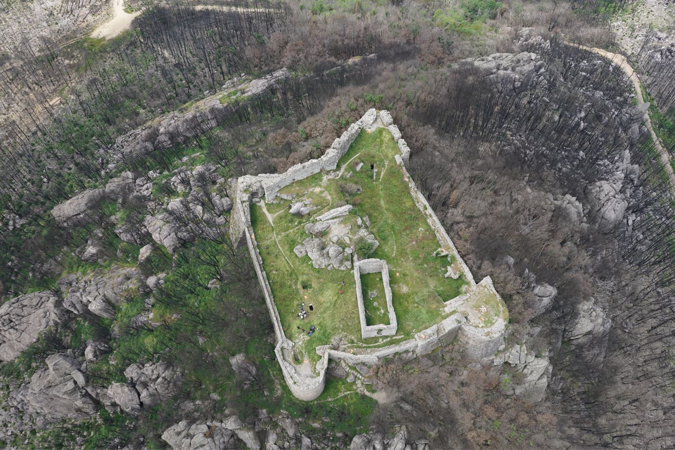
The fortress – or “Rocca” – of the Verruca is an ancient and ruined military bastion with a quadrilateral plan, located upon the Pisan Mountains, between Vicopisano and Calci (Tuscany, Italy). Despite the almost absence of original documents that can accurately indicate the period of construction of the fortress, most historians place its birth between the XII and IX centuries. Its importance in the past was mainly due to its strategic position on the summit of a rocky spur and its considerable height (525 m above sea level), which made it become a crucial defensive structure for the Pisan Republic before being abandoned for good in the XV century.
For this reason, nowadays, this stone fortress is in an advanced state of decay: amid the vegetation stand the walls (today only partially crenelated) that connect the circular towers and the ramparts of the four sides of the fortress. The interior space, totally invaded by debris, vegetation, and rocky boulders of Mount Verruca, includes a small parade ground and the remains of what many think was the architectural structure of a church (Fig. 1).
Survey goals and data acquisition
The location of the Verruca fortress, not so easily accessible, clearly influenced the survey’s planning and the approaches to use. In this sense, photogrammetry and laser scanning immediately proved to be the ideal and non-invasive solution to reconstruct in 3D the derelict building. The final goal of this project was the acquisition of a series of plans, elevations, sections, and orthophotos, essential to perform instrumental analysis through the study of the morphological profile of the rock and identify the degree of damage and deformation.
Data collection dates back to April 2019, in which a Leica RTC360 laser scanner and a Leica AX20 drone were used, equipped with a full-frame Sony α7R II mirrorless camera, with a 42.4 MP CMOS sensor. Besides, 9 ground targets were placed and their corresponding GPS coordinates were collected.
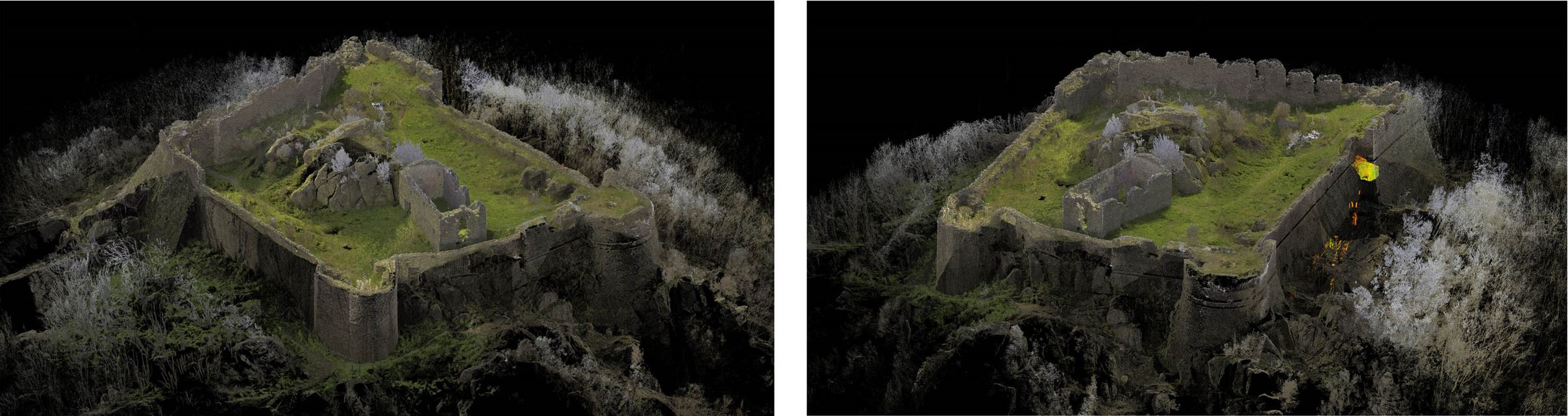
The synergy of these two technologies allowed, on the one hand, to get highly accurate and georeferenced point clouds, and on the other hand, to integrate and leverage photographic information to extract orthophotos and elevations at the highest quality and resolution (Fig. 2 – 3).
During the flight, the drone covered the interior plan and the outer ramparts of the fortress, carrying out 3 flights and collecting a total of 711 images in JPG format with a fixed focal length of 28 mm: the first flight took nadiral photos of the ground following a preset route, while the other two were performed in manual mode by flying around the fortress and taking oblique images to capture the details of the outer ramparts.
The camera parameters used during the photo acquisition parallel those normally exploited in aerial drone photogrammetry: very fast exposure times (between 1/500 and 1/200 sec.), aperture between f/5 and f/5.6, and ISO 100.
Final Outputs
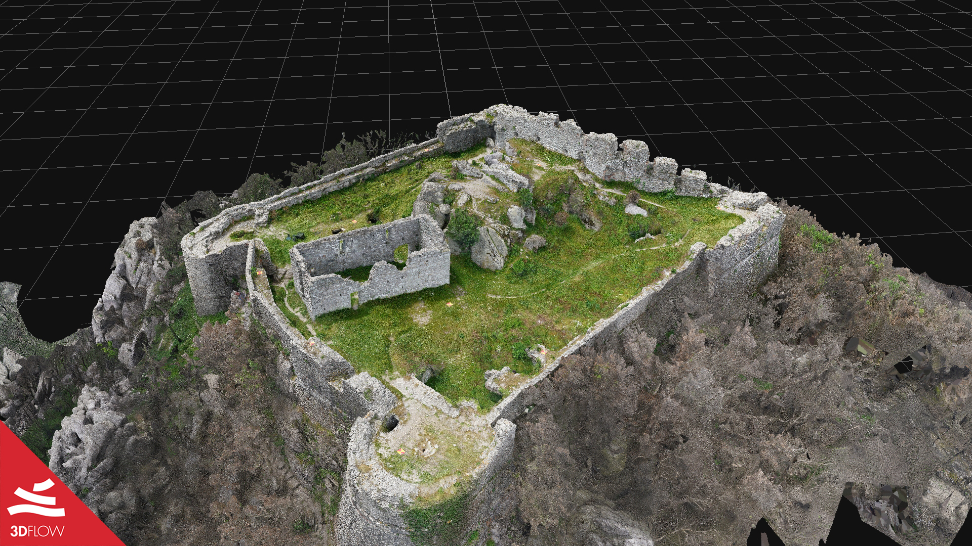
After the photo acquisition phase, 682 final images were imported and oriented into 3DF Zephyr during the 3D reconstruction process. The photogrammetric point cloud was later merged with the laser scans to produce an even more detailed model, as well as scaled and geo-referenced. Further outputs were extracted in Zephyr: a top-view orthophoto of the fortress (Fig. 4) and the elevations of the four sides of the walls.


Fig. 4. Top-view orthophoto (left) and elevation (right) of the fortress’ plan – Scale 1:100. © Giovanni Pancani – DIDA UniFI
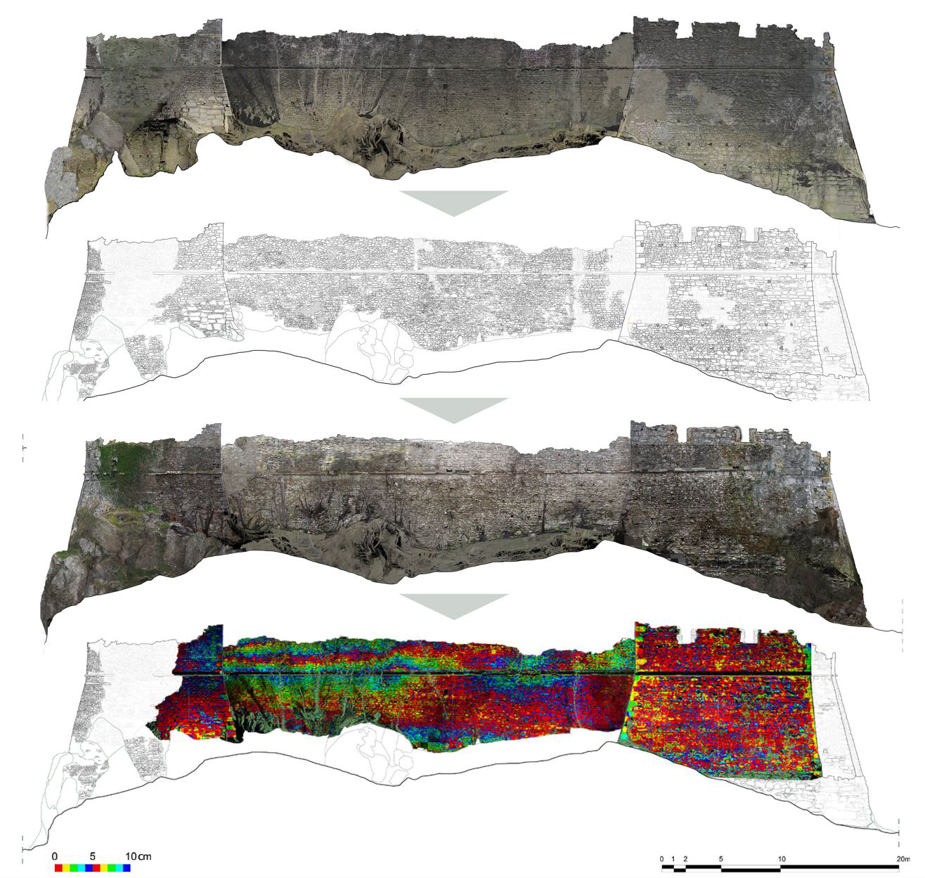
From these outputs, they obtained sections, details, and elevation maps (Fig. 5) of the fortress’ surface, thanks to which they then carried out a whole series of analyses on its structural morphology. The data was necessary to have a general picture of its state of deformation, allowing correct monitoring and diving more into the analysis of dissections in the future.
Here below you can watch the video of the 3D final model from photogrammetry – dense point cloud and textured mesh – made with 3DF Zephyr.