Hi modelers,
we want to feature the following report made by Francesca Sileci (Politecnico of Torino) and describing an approach to Aerial Photogrammetry via 3DF Zephyr Aerial. The outcomes will be joined her master’s degree thesis entitled “From Geomatics to BIM: the case of the amphitheatre of Pollenzo”.
The amphitheatre of Pollenzo
In order to arrange a master’s degree thesis focused on the amphitheatre, I have exploited 3DF Zephyr Aerial as photogrammetric software to process data acquired by means of aerial photogrammetry, after performing more than one survey carried out along with a team of Geomatics at the Politecnico of Torino.
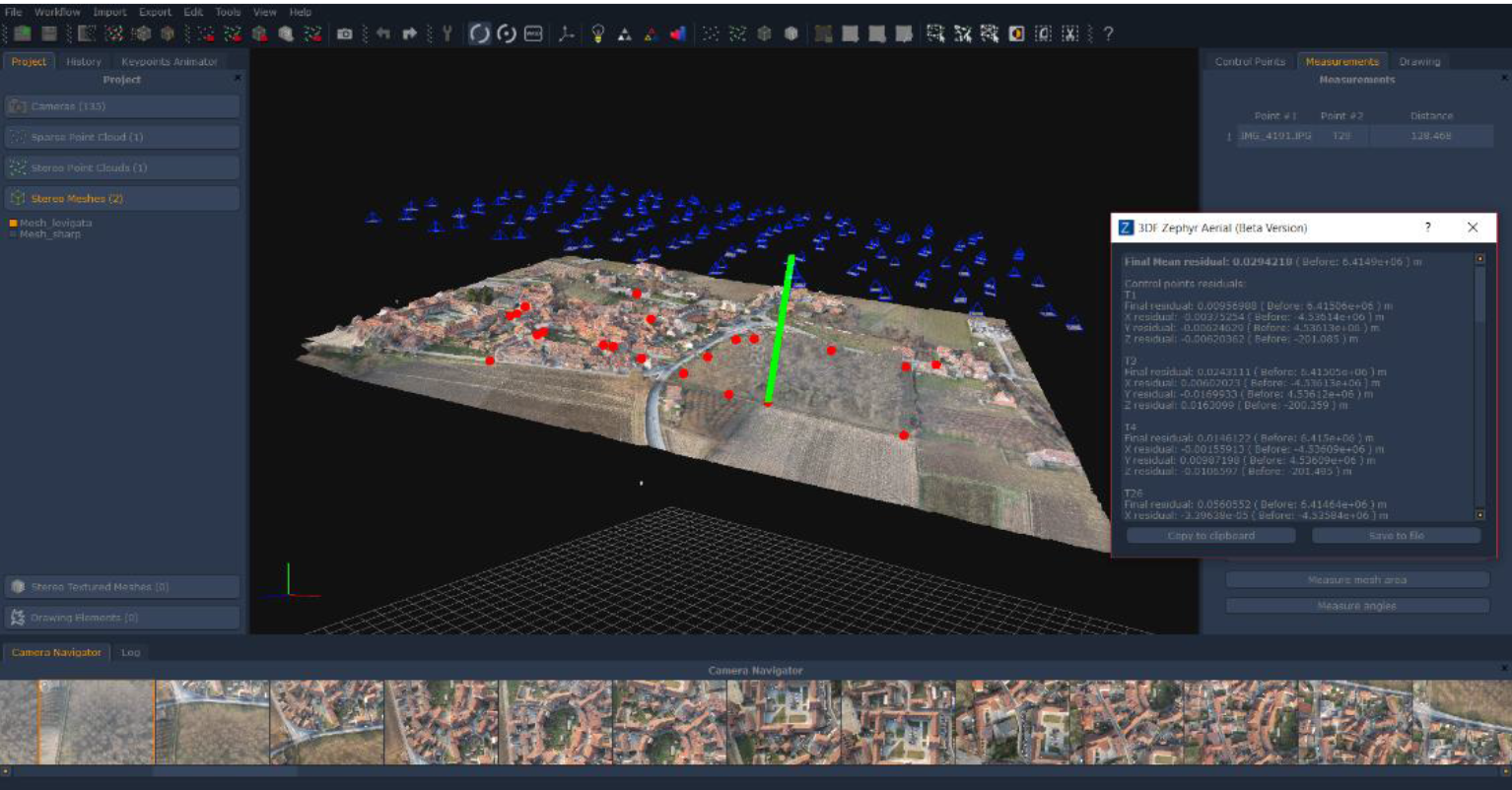
The very first test run with 3DF Zephyr Aerial had given a Final Mean Residual error of 1.42 m. As the expected error on this kind of elaborations has ranged from 2 to 4 cm I have then carried on performing some other tests so as to produce a better result.
I have started my work loading cameras positions coordinates within the software application. Then I have worked with a manual calibration I have created beforehand, although 3DF Zephyr does not need that since it is able to automatically determine the camera calibration. As a Canon Power Shot ELPH 110 HS has been used to collect the pictures I have chosen the “Adjust tangential distorsion” parameter before running the Structure from Motion process.
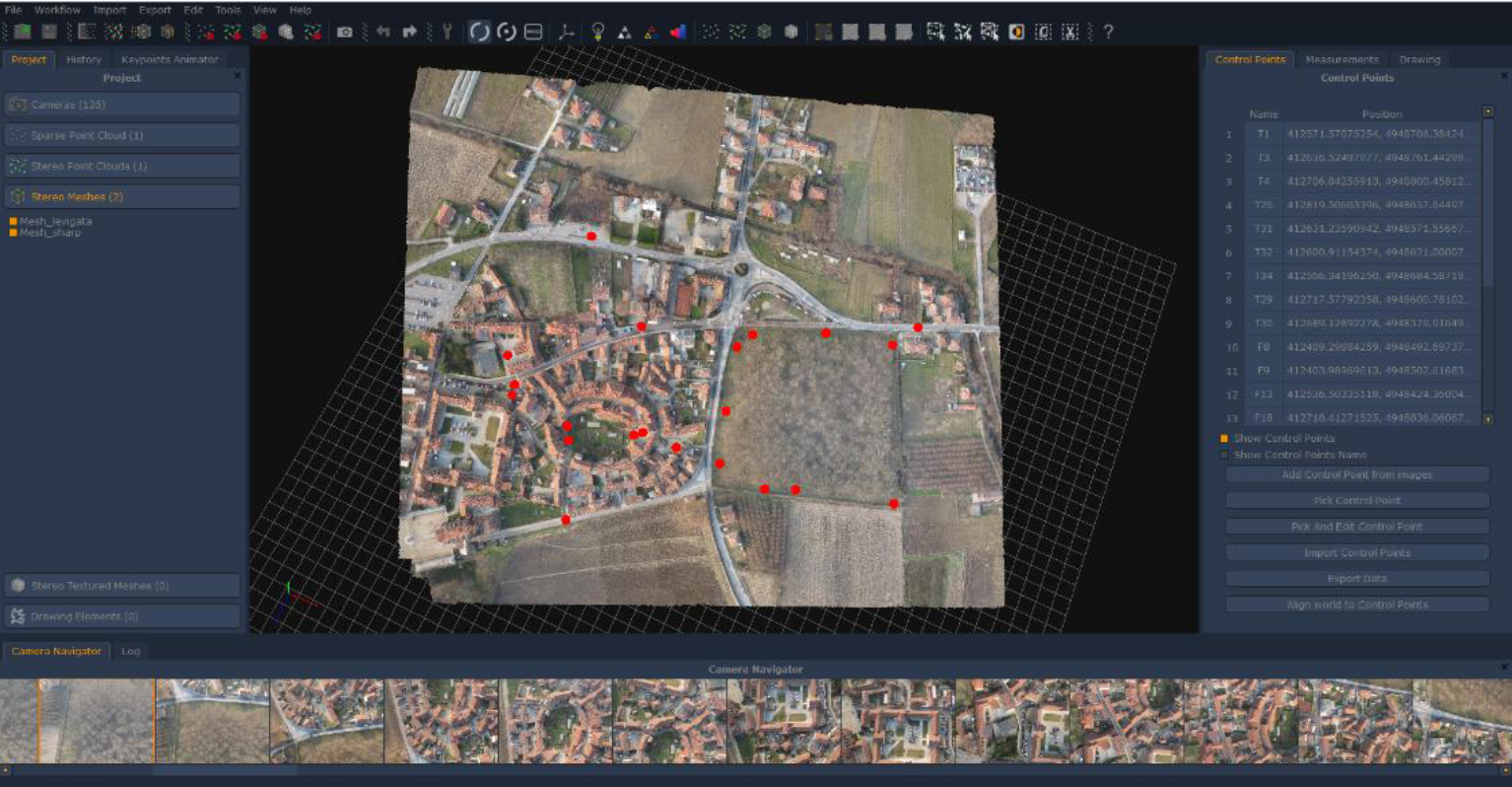
After generating a sparse point cloud and before starting the dense one I have placed 44 control points directly on the images, matching each one of them on at least three pictures. That has been a crucial phase to produce an accurate result; I have noticed some wrong coordinates taken in field and thus removed certain control points, especially those carrying the higher residual error value.
In the end, I started by having 44 control points which were then reduced to 17 on each control point removal iteration (namely: 36, 26, 21 and finally 17)
I have succeeded in gaining a final residual error of 0.029 m by computing bundle adjustment once again. That error value is even more remarkable considering the height of photographic acquisition (127 meters).
Topographic survey has been carried out with GNSS system in RTK modality so as to get orthometric heights and to load them within the software.
Francesca Sileci